Showing posts with label Infrastructure. Show all posts

Wednesday, March 11, 2015

Population Explosion

I described in an earlier post my algorithm for placing the capital city in each of my countries, expanding on that I wanted to gather some more information about the make up of each country so I can make more informed descisions about further feature creation and placement.

One key metric is the population for the country as knowing how many people live in each country is key in deciding not just how many settlements to place but also how big they should be.  Until this is known much of the rest of the planetary infrastructure cannot be generated as so much of it is dependent upon the needs of these conurbations and their residents.
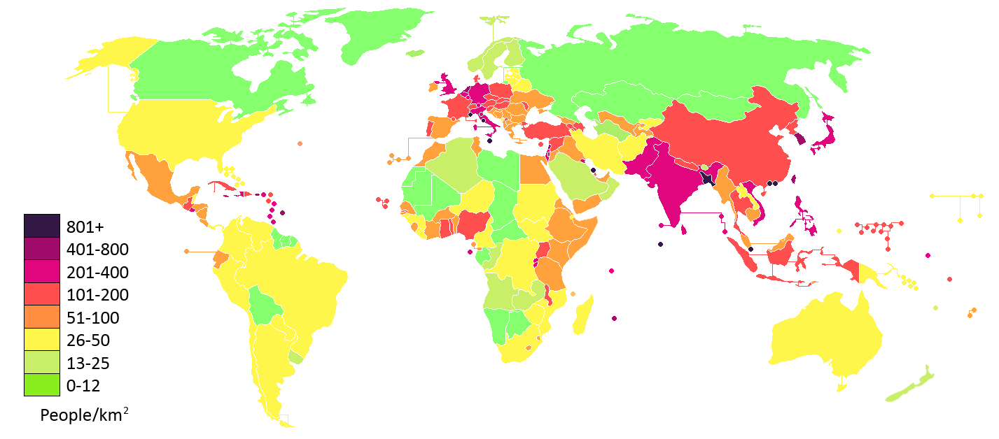
World population density by country in 2012.
(Image from Wikipedia)
A completely naive solution would be to simply choose a random number for each country but this would lead to future decisions that are likely to be completely inappropriate for both the constitution of the country's terrain and it's geographical location.  A step up from completely random would be to weight the random number by the country's area so the population was at least proportional to the size of the country but again this ignores key factors such as the terrain within the country - a mountainous or desert country for example is likely to have a lower population density than lush lowlands.

To try to account for the constitution of the country's physical terrain rather than just use the area I instead create a number of sample points within the country's border and test each of these against the terrain net.  As mentioned in a previous post, intersecting against the triangulated terrain net produces points with weights for up to three types of terrain depending on the terrains present at each corner of the triangle hit.  By summing the weights for each terrain type found on each sample point's intersection I end up with a total weight for each type of terrain giving me a picture of the terrain make across the entire country.  I can tell for example that a country is 35% desert, 45% mountains and 20% ocean.

This is of course just an estimate due to the nature of sampling but the quality of the estimate can easily be controlled by varying the distance between sample points at the expense of increased processing time.  Given a set number of samples however the quality of the estimate can be maximised by ensuring the points chosen are as evenly distributed across the country as possible.

The number of samples chosen for the country is calculated by dividing it's area by a fixed global area-per-sample value to ensure the sampling is as even across the planet's surface as possible - currently I'm using one sample per 2000 square kilometres.  Once the number is known the area of each triangle in the country's triangulation is used to see how many sample points should be placed within that triangle.  Any remainder area left over after that many samples worth of area has been subtracted is propagated to the area of the next triangle - this also applies if the triangle is too small to have even a single sample point allocated to it to make sure it's area is still accounted for.

If a triangle is big enough to have sample points allocated within it those points are randomly positioned using barycentric co-ordinates in a similar manner to how the capital cities were placed.  There is nothing in this strategy to prevent samples from adjacent triangles from falling close to each other but in general I am happy that it produces an acceptably even distribution with a quality/performance trade-off  that can easily be controlled by varying the area-per-sample value.

So given the proportion of each type of terrain making up a country how do I turn that into a population value?  I assign a number of people per square kilometre to each type of global terrain, multiply that by the area of the country then by the weight for that type of terrain to get the number of people living in that type of terrain in the country then finally sum these values for each terrain type to get the total number of people in the entire country.

I've produced these people-per-Km2 values largely by using the real world figures for population density found on Wikipedia as a basis.  Using figures a year or two old, the Earth has an approximate average population density of just 14 people per square kilometre when you count the total surface area of the planet but this rises to around 50 people per square kilometre when you count just the land masses.  

As shown on the infographic above however the huge variety factors influencing real world population density lead to some areas of the planet being very sparsely populated with only a couple of people per square kilometre while other areas have 1000+.  There isn't enough information present in my little simulation to reflect this diversity yet however so I'm currently working with a far more restricted diversity based around the real world mean.  The values I am currently using are:

Figures for how many "people" to create per square kilometre for each terrain type 
So given the fairly random distribution of terrain on my planet as it now stands what sort of results drop out of this?  Currently the terrain looks like this:

The visual planetary terrain composition, currently the ocean terrain type has a slightly higher weighting so there is more water surface area than any other single terrain type  
while making 100 countries produces the figures shown here

Terrain composition for a number of the countries along with their resultant population densities by total area and by landmass area
As can be seen basing the terrain population densities on real world values has generated a planetary population not too different to our own but as my planet is currently 24% water rather than the 70% or so found on Earth the actual densities are probably on the low side.  The global terrain composition is currently made up like this:

Proportion of the planet covered by each terrain type and resultant contribution to the planet's population

What is interesting is that the sampling strategy ensures that the population count properly reflects the proportion of the planet that is land mass - you can see countries such as Sralmyras which are 32% water have a lower population density by area of just 13 while Kazilia which is 7% water has a density of 17 people per Km2.

With a population count my plan is to now use that in conjunction with the terrain composition profile to derive a settlement structure for each country so I know how many villages, towns and cities to create.  Watch this space.

Saturday, February 7, 2015

Capital Cities

Following on from Country Generation, I thought I would take a look at placing some capital cities in my newly established countries as a precursor to more general settlement placement encompassing everything from hamlets and villages up to towns and other major cities.

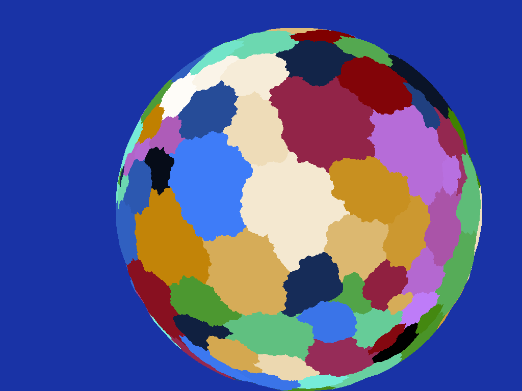
As a quick recap, here is my planet with the country boundaries highlighted:


So the challenge here is to pick an essentially random  location within the country boundaries that is suitable for it's capital city.  As I already have a triangulation of the country to be used when deciding within which country a point on the planet's surface lies, I can use this to place the city.  Rather than picking random points on the planet in the hope of eventually finding one that lies within the country of interest however it makes more sense to pick points within the triangulation to start with.

The simplest way therefore would be to just pick a random triangle from the country's triangulation then pick a random point within it.  The first is trivial while the second can also be easily accomplished using barycentric co-ordinates to convert three random numbers in the range [0, 1] into a point within the triangle.

While this works, I didn't want capital city placement to be completely random, for my purposes I didn't want a capital city that was too close to the country boundaries but with the naive approach described above there is nothing to stop a capital being right on the border.  This is purely a subjective restriction and I'm sure somewhere in the world there is a capital very close to a border but it just didn't feel right to me.

Unfortunately determining the distance between a point within a country and it's border isn't a trivial task, requiring the distance to each line segment making up the border to be calculated and the minimum taken.  Determining what is an acceptable distance is also not as easy as it might be due to the wildly varying shapes of the countries.  An acceptable distance for a generally circular country might be impossible to satisfy for a different country that was long and thin.

There isn't much that can be done to alleviate the first issue other than test as few candidate points as possible and possibly use some sort of spacial index to reduce the number of border segments being processed - while it's a bit brute force however it's not prohibitively expensive so improving it isn't top priority.

Without any particular knowledge of a country's shape however determining an acceptable distance from the border to place the capital city is a bit more of a challenge.  Rather than try to work out some sort of heuristic from the border vertices I chose instead to use a sampling approach.  For each country a number of random points are generated using the simple algorithm above and the distance from each to the country's border calculated.  The point that is furthest from the border is chosen as the position of the capital city.


The number of points to test is a little trial and error - sample too few and you might not pick a point that's far enough away from the border to be acceptable while sample too many and you will inevitably end up with a point pretty much in the middle of every country which is too uniform and also unacceptable.

I ended up taking 25 sample points for each country which I think gives a decent spread of capital positions while still not generating any too close to the borders.

I am hoping the system can be extended to start placing secondary and tertiary settlements by adding other factors to the heuristic such as distance from already placed settlements (scaled by the relative sizes of each settlement) along with some physical factors such as the candidate site's proximity to rivers or bodies of water to encourage settlements in coastal areas and the general flatness of the terrain to make lowlands and valley floors more appealing than steep mountain sides.

For reference I thought it would be worth including an illustration of the triangulation generated from the country boundaries, as you can see the simple ear-clipping algorithm used tends to produce long thin triangles.  These don't affect the functionality of the system but at some point in the future I might be adding these triangles to some sort of spacial organiser to improve query performance in which case a triangulation that was a bit more evenly distributed across the surface might be better, but it will do for now.


Then of course there is generation of the actual cities themselves complete with road network and buildings, so there is as ever plenty to do!

Wednesday, October 15, 2014

Country Boundaries

After spending some time on a system to make names for places as described in my last project post I thought it would be interesting to look at creating countries for my planet I could then attach such names to.  I wanted to create a system where I could determine from any point on the surface of the planet which country it was part of.

I thought the easiest way to go about this would be to create a triangulated shell around the planet against which a ray from and normal to the surface could be intersected, the triangle that was hit would let me know which country the point was within.

My very first go at this involved setting up an array of 200 points chosen at random around the surface of a sphere enclosing the planet, these were created by simply choosing random numbers in the [-1, 1] range for the X, Y and Z positions then normalising the resulting vector. Once I had these I use the QuickHull Algorithm to produce a triangulation of the convex hull formed by these points and assigned a country ID to each - albeit really just a colour at this point.  The control net mesh looked like this:

Triangulation of country control net created purely from seed points
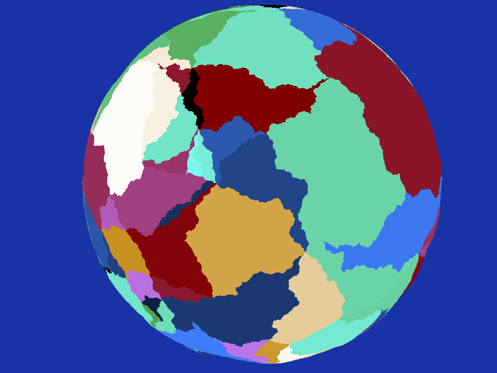
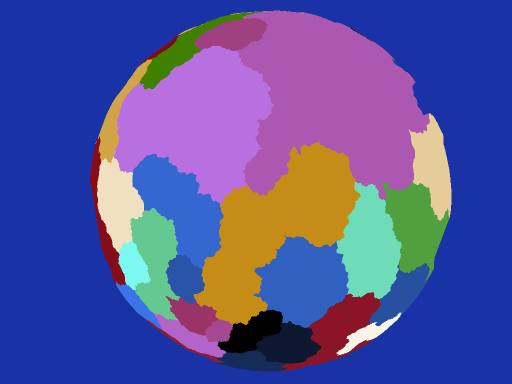
For now I'm just using a sphere created by subdividing an Icosahedron for my planet's terrain and it's purely spherical with no elevation variation to ease visualisation.  Taking the centroid of each terrain triangle and shooting a ray from it normal to the surface against the country boundary control net described above then colouring the terrain triangle with the country ID proves the concept of determining countries from surface points:

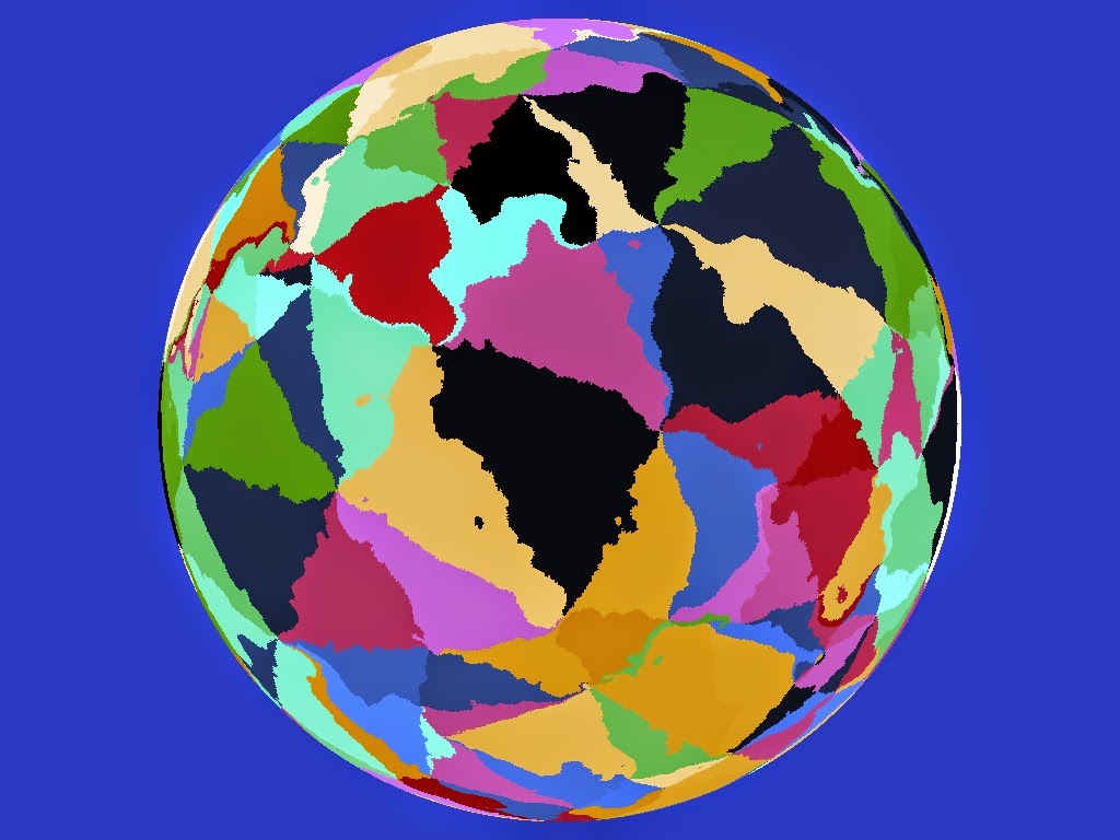
Countries found by ray-casting from the surface
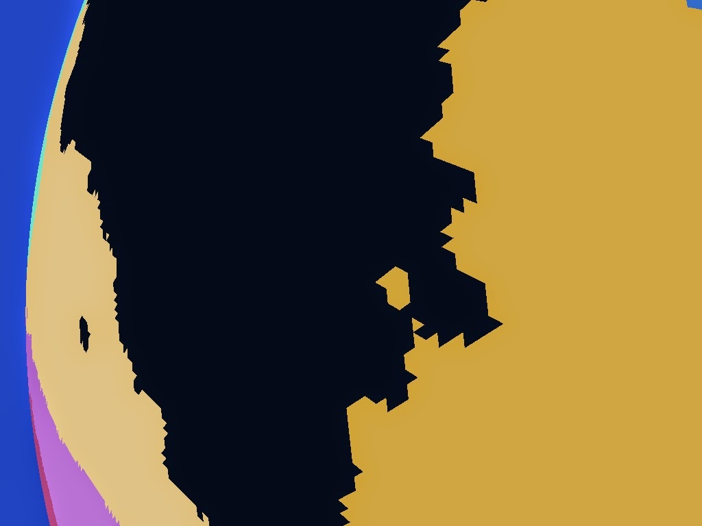
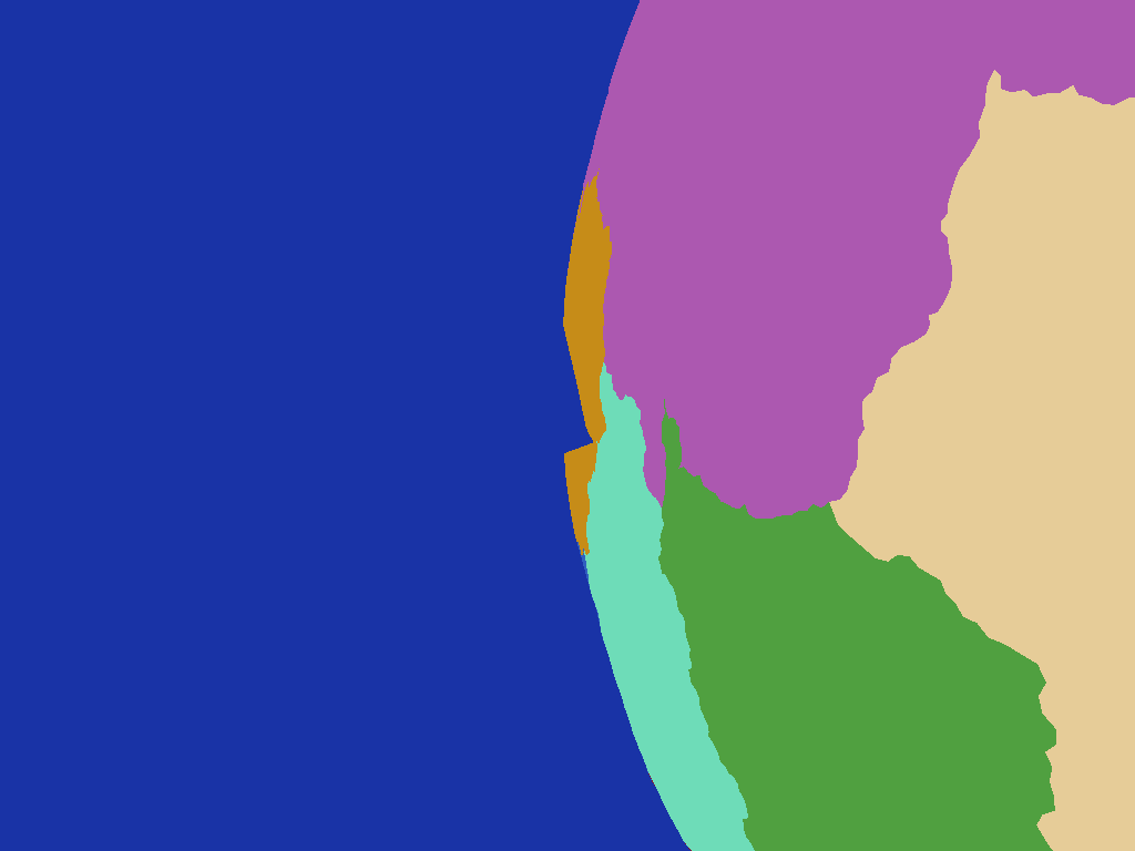
Note the jagged edges of the triangles here (shown in close up in the top corner) in contrast to the smooth ones in the direct rendering of the control net above - remember this second image shows the individual terrain triangles flat shaded, effectively point sampling the country control net.

Unless you know of a planet with purely triangular countries though it's not particularly realistic.  To make the results a bit more organic I played with adding some noise to the vector shot from the surface against the control net which initially produced some slightly more encouraging results:

Perturbing the ray from the surface
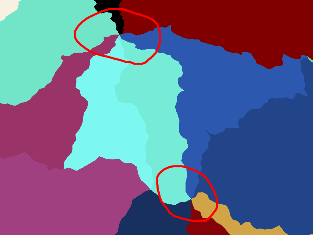
The triangular nature of the control net however is still quite apparent and more problematically closer examination reveals there are problem cases where the noise causes unrealistic "bubbles" of a country to leak into adjacent countries due to the perturbation of the vectors being intersected against the control net.  This occurs most near the country boundaries as points on one side can end up being displaced enough to end up embedded in the neighbouring country:

"Bubbles" of one country leaking into it's neighbour
This is not something you generally see in the real world and was what I felt to be an unacceptable results which unfortunately I couldn't think of a way to correct.  I ruled out noise perturbation as a result and went back to the drawing board.

Edge Subdivision 


Instead of noise then I had to come up with plan B - my second approach was to subdivide the edges of the triangles adding displacements to the introduced points to make the edges more interesting.  In this way the boundaries can be more interesting while still preventing "bubble" errors.  The process here is to recursively divide any boundary edge over some minimum length introducing a new boundary point in the middle of it.  The cross product of the edge vector and the normal gives a tangent which is used to displace this new point by some random amount.  The magnitude of this displacement is capped to be a proportion of the length of the edge so long edges have their midpoint displaced further than short edges to keep things in proportion.

Subdividing the edges did turn my nice triangles into n-gons so I also had to add in a triangulation step to turn each set of country boundary points back into a mesh I could both ray test against and render for debugging purposes.  As I knew the boundaries couldn't have holes I used the trusty Ear Clipping Algorithm as it's so simple to implement and fast enough for this case.

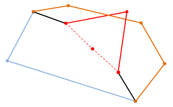
There is still a potential for error here though as there is a possibility that the displaced midpoint might end up within an adjacent country's boundary causing the boundary edges to intersect creating invalid boundary pockets:
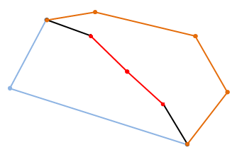
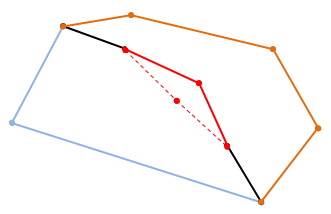
An edge between two countries that has been subdivided
Displacing the newly introduced midpoint perpendicularly to the edge by a distance proportional to the edge's length to make the boundary more interesting...

...but if you displace it too far the new edges can intersect the other existing edges of one or other boundary making an invalid boundary
So for each potentially displaced midpoint the two edges that would connect it to the original edge's end points are tested for intersecting any of the remaining edges of the two boundaries that adjoin across the edge being split.

If no intersection is found the displaced point is valid and I move on testing the two created edges to see if they in turn can be sub-divided, if however either of the two new edges intersect a remaining edge I have to pick a new position for the midpoint and try again.  To reduce the chance of getting stuck trying to find a valid position each time I have to reposition it I reduce the maximum magnitude of the displacement with each attempt so the new midpoint gradually tends back to the original edge.  If the magnitude gets so low it's not worth dividing the edge at all I just give up, leave the original edge undivided and move on to the next edge.  This only tends to happen in highly acute boundary corners where slivers are produced.

Running the process dividing any edge longer than 50Km gives a noticeably better result than the simple triangles I started with:
Country control net produced by subdividing edges of triangular countries
Although it's better there is no getting away from the fact that I started with triangles and I was still not particularly happy with it.  To make the country shapes more interesting my next step was to randomly take pairs of adjoining countries and merge them together producing fewer hopefully more interesting shapes:

Randomly merging adjacent countries helps obscure their triangular origins somewhat
Another improvement but again to me it's still quite obvious I started with triangles - there are a large number of nexus points where to my mind an unrealistically high number of countries meet at a single place:

Unrealistic nexus points where many countries meet, another consequence of the triangular basis
I experimented with increasing the number of seed points which meant more smaller triangles to start with but although the effect was improved a bit more it felt more like treating the symptom than a cure.

Dual Meshing


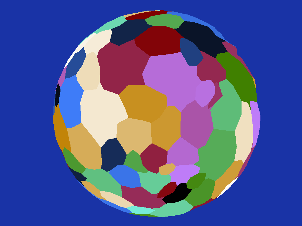
Rather than shrink the triangles I thought it would be better to start from a more friendly base so instead of using the triangulation of the convex hull surrounding my initial seed points I instead calculated the dual of this mesh effectively producing faces surrounding each seed point rather than passing through them.  This immediately gave me what I thought was a better initial mesh, effectively similar to a 3D Voronoi diagram:

Using the dual of the triangular mesh produces better country shapes as a basis
Running the edge subdivision on this mesh finally gave me a result I was pretty happy with:

Subdividing the edges of the new countries makes them more realistic
I also added back the random merging of adjacent countries to make things more varied:

Randomly merging adjacent countries provides more variety of scale
Note how the irritating nexus points no longer feature, the countries join in what I feel to be a far more realistic manner.  The main issue I have with it now though is the countries before merging are a bit too similar in size causing the result to be a bit uniform - I think in the future I'll play around with clustering the seed points somehow instead of having them uniformly random and see how that affects things.

Note the triangulation of the country boundary control net doesn't necessarily produce a spherical mesh as such as the edges of triangles spanning large areas will at times be much closer to the centre of the sphere than their unit length vertices producing odd looking kinks in the geometry:

An obvious kink in the yellow country caused by the control net's triangles spanning a wide solid angle on the planet
this isn't a problem however as remember I'm not normally rendering the country boundary geometry directly, I'm just intersecting rays shot from the far denser planet surface mesh against it to determine which country a point is located within.

A Note on Ray-Triangle Intersections


While working on this there were a number of times when I had to intersect rays or 3D line segments with triangles.  I was using a trusty old intersection routine I've had kicking around for years but found that even with double precision there were times when a ray or line would be reported as missing a triangle that it really should have intersected, usually when falling on an edge between two adjoining triangles.  Puzzled by this I did a little research (i.e. consulted Google) and found a better intersection algorithm specifically designed for intersecting with meshes, "Watertight Ray/Triangle Intersection"

Implementing this solved all my problem cases in one fell swoop so it turned out to be a good find, if you are interested in using it do note however that there appears to be a minor error in the code presented in the paper, see near the bottom of this blog post for more info.

Conclusion


Although this has been focussed on country generation, while working on it I have thought that the system could also be used to produce areas of water for oceans and seas by simply flagging certain boundaries as water zones.  This would produce some nicely shaped features while avoiding the problem of parts of a country being underwater if water was placed by a different system.  I will need to feed the country boundaries into the elevation production system however for this to work so the water zones and coastlines are given appropriate topology.  Something for the future anyway.

So there you have it, a set of what I feel are quite realistically shaped countries I can use to move on to the next step, possibly placement of towns and cities followed by primary road or rail networks...that sounds like it should be interesting to look into anyway.

Sunday, July 13, 2014

Nomenclature

I've had to take a bit of a break from project work recently due to other commitments but hopefully I'll be able to get back to at least tinkering with things soon.  As a bit of a preamble to that I've been looking at a bit of a fringe task for procedurally generated worlds, namely the procedural generation of names.

My plan for the near future is to focus  more on generating a plausible political and logistical infrastructure for a planet instead of purely working on the visual terrain as I have done many times before so I'm going to need to be able to name things be they continents, countries, regions, cities, airports, premiers or whatever.  This is a completely new area to me and so sounded like an interesting diversion.

There are many ways to procedurally construct names ranging from simply producing random sequences of letters to utilising complex linguistic rules but the one I chose to experiment with was the use of Markov Chains (http://en.wikipedia.org/wiki/Markov_chain), an algorithm that decides what comes next in a sequence by looking only at the preceding X elements and using some probability tables to decide what's most likely to follow.  In my case the sequence is the letters of the name being generated so by looking at the last so many characters of the name so far I can choose a plausible next character and so on.

So where do these probability tables come from?  Well to make names that look sensible I thought it best to reference the real world as a starting point, so to generate names for countries I use a set of 275 real world country names as my exemplars - something that's not too hard to come by these days thanks to the internet.  These real names are analysed to store the probability that any given sequence of characters is followed by another, for example it may be that 23% of the time the letter 'a' is followed by the letter 't', or that 15% of the time the sequence "tr" is followed by the letter "s" in the real world names.

The resultant behaviour of the algorithm is heavily dependent upon the size of the exemplar pool but even more significantly upon the number of characters you look at when deciding what might come next.  For example running the same algorithm with the same exemplars but different length groups produced the following sets of names:


It's immediately obvious that the longer the character sequence examined the more rigidly the generated names stick to the exemplars while the shorter the character sequence the more variety the generated names exhibit.  The extreme example here is table (1d) where only the last character emitted is used to decide what comes next resulting in a virtually random sequence of characters that bears little resemblance to the exemplars or even anything vaguely pronounceable!

Of the variations I think the three character sequence version (1b) is most promising but while the longer sequence length prevents too much randomness in the output at times there simply isn't enough randomness meaning that the generated names are quite similar or even identical to the real world exemplars.  There is also nothing preventing the same sequence being generated more than once such as "falklands uk".

To address the first of these issues I decided to run a check on each generated name to see if it was different enough to the exemplars to be accepted.  This is done by comparing the generated name to each exemplar and calculating the Levenshtein Distance between the two strings (http://en.wikipedia.org/wiki/Levenshtein_distance), essentially the minimum number of single-character edits (insertions, deletions or substitutions) required to change one word into the other.

By rejecting any generated names that produced a Levenshtein Distance to any exemplar that was too low we can help ensure that we don’t accidentally end up with something too similar to a real world place name.  Running the same test again but now with this added exemplar distance check rejecting any generated names with an exemplar distance score of less than two we get a better selection of plausible but not actually real world names:


Note here that the distance check is performed on each separate word of the generated and exemplar names separately to avoid generating names where one word is unique but the other lifted straight from an exemplar - certain key words such as "the", "of" or "island" are exempted from this check however as they are perfectly valid in the output.

As an experiment, running the test one final time but this time with the distance rejection limit raised from less than two to less than five produced these country names:


Comparing these to the previous test's output the biggest change here is with the longer character sequence generated names (3b and to a lesser extent 3c) as the distance check has rejected anything even remotely similar to one of the exemplars causing far more random and less recognisable names.  The shorter sequence names at the bottom have been less affected as they were pretty random to start with.  Note there is no four character sequence output here as the system was unable to generate any names using that most restrictive of criteria that also passed the distance check - the names were by definition most similar to the exemplars therefore least likely to have an acceptably high distance score.

So far these have all been country names but how does the system work with a different set of exemplars?  To find out I used it to try to generate plausible city names instead - first using a full set of 26914 Earth city names with a three character sequence length and a distance threshold of three:


As you can see there is a lot of variety in the names reflecting the huge real world variety of city names depending on culture and language, as one of my main goals at the moment is to produce a procedural world that exhibits more heterogeneity than it typically found by global application of procedural systems however this one-size-fits-all name style is not really what I'm after.

By limiting the set of exemplars to those real world cities from a particular country however more localised results can be achieved.  Out of interest I ran the system over just those real world city names from the United Kingdom, United States, France and Japan in turn to see how closely the output would reflect their dramatically contrasting morphology:


I'm no language expert but to my layman eyes the output from each while varied amongst it's peers is noticeably different from those in the other tables which I think is good enough for my needs - I just want each of my virtual countries to have an identity reflected in it's nomenclature.

These tables have been generated from just a few runs and with specific parameters, but it's important to bear in mind that when used for real the exemplar pool, sequence length and the distance threshold can all be varied each time a name is needed providing a steerable but near limitless potential set of generated names.

Anyway, I’m happy enough with it for now so I’m going to move on to something else...comments as always are welcome


Saturday, August 13, 2011

Building Placement Revisited

Although the building lot generation system I described in my earlier post did produce results, the quality of those results was far from ideal. Despite the time spent on it and the various techniques tried the lots it produced were neither very well distributed, controllable in formation nor very practically shaped. Rather than soldier on into procedural architecture generation with such ill suited foundations I decided to have one more attempt at cracking the problem, and I'm very glad I did.

Looking at it after a break of a few weeks not working on the project gave me a valuable fresh perspective and I realised that maybe the whole chart subdivision plan was flawed, maybe there was a better way. Rather than abandon charts altogether though I came up with a new way to use them - rather than splitting them up to try and make lots I thought it might be interesting to start with tiny "seed" lots placed in locations and with orientations I already knew to be sensible then apply some sort of iterative growth algorithm to let them fight it out in a sort of survival of the fittest manner.

The best starting position for this free-for-all seemed to be placing a seed lot half way along any chart edge longer than some minimum threshold. This not only ensured the lots would follow the roads exactly but also made it easy to determine the building front side. Each seed lot is a small square only a couple of metres in size, their initial placements in my test city can be seen here:

Seed points for lot generation
With these seed positions set the system then repeatedly iterates over each in turn attempting to grow them a small amount in each of the three directions not adjacent to the road. By growing each only slightly each time the lots all expand pretty evenly to fill the available space. Growth in a particular direction only stops when that edge of the lot hits another lot, an edge of the chart that contains it or if it has grown too far beyond the length of the chart edge that created it. Lots also stop growing in depth if it would cause them to be too much deeper than they are wide as it's rare to find many buildings significantly deeper than they are wide - the actual aspect ratio limitation can of course be tweaked.

Should a lot run out of space before it reaches the minimum size threshold required to place a building on it the lot is flagged as invalid and other lots allowed to grow into it's space if required. Once all lots have grown as much as possible the process is complete.

After a dozen iteration the above seed lot layout produces this completed result:

After 12 iterations no more lot growth is possible
It's immediately obvious that this new system produces a far more ordered and sensibly laid out set of building lots. They are all nice and rectangular, are oriented neatly along the roads while also using up most of the available space.

The image below illustrates where the invalid lots that didn't survive the cut were located:

Lots in red are too small for buildings and are discarded
Although all were rejected because they weren't large enough to put buildings on, you can see a couple have had their space partially used by other valid lots to maximise their own area.

One final check that is also performed is that building lots larger than a certain size are subdivided along their width into a number of sub-lots that meet the size criteria.  This maximum size is a function of the distance from the population centre so building lots nearer the centre of the city are allowed to be larger than those in the suburbs.  In the next image lots in blue are the result of subdivision in this way:

Lots in blue are the result of subdivision of larger lots
I'm not sure whether to keep this step or not, I think it depends on the variety of building that the architecture system will be able to produce - if believable large suburban buildings can be generated (shopping malls or sports centres perhaps, possibly large mansion type houses) then it would make sense to keep some large plots for their placement.  For now though I am keeping things aimed at houses in the 'burbs.

Placing my simple building place-holder object on these new lots and giving them heights based upon their distance from the population centre gives what I think is a fairly decent looking impression of a city for such a graphically simple representation:


Adding some road geometry with a number of lanes based upon the generation number of the road in the road network generation system and some basic pavements gives some other pleasing results:


Overall I'm quite happy with the new system and am definitely much happier about moving on to look at procedural architecture with this better foundation.  It shows if nothing else that if your instincts are telling you that a system is not up to the job, it's often best to listen to them!